Which 4x4 should I rent in Namibia?
Hilux, Fortuner, Jimny or Land Cruiser camper? Choose by group size, route, camping vs lodges and budget, with honest trade-offs and real day rates.
Read more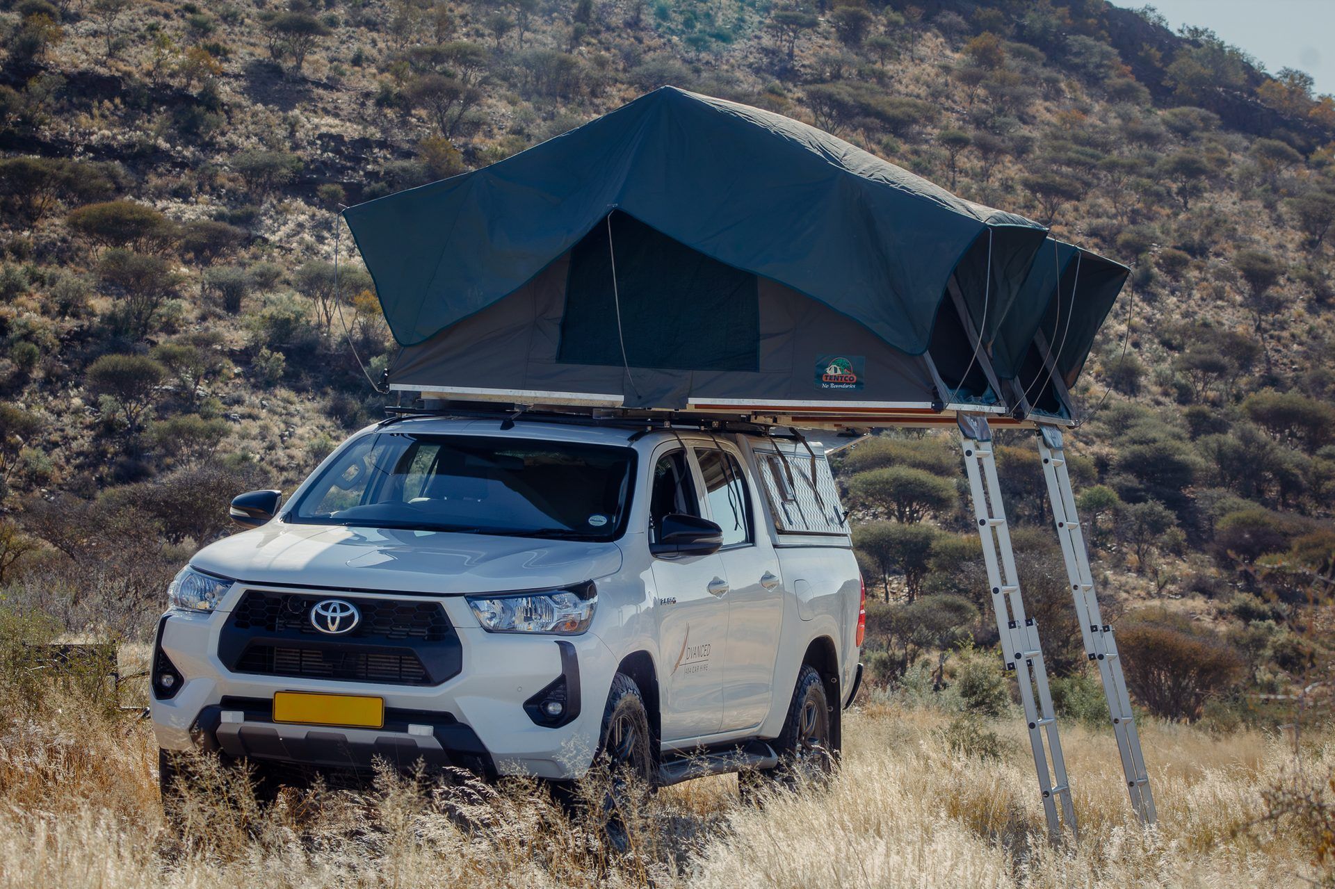
Guide
Three circuits, every distance honest, every cost explained. Planned and written by Advanced Car Hire, the family-run 4x4 company in Windhoek that has been equipping self-drive trips across Namibia since 2003. Read the whole guide on this page, or get the complete guide as a PDF below and take it with you.
Get the complete guide as a PDF, free by email: all three circuits, every table and the checklist.
Namibia rewards people who plan the shape of a trip and then relax inside it. The distances are long, the roads are mostly gravel, and the best moments tend to happen at waterholes, dune crests and small towns that no itinerary can schedule precisely. What an itinerary can do is protect you from the two mistakes that spoil trips here: driving too far in a day, and arriving somewhere after dark.
This guide gives you three complete circuits that we have refined over two decades of handing over vehicles in Windhoek. The Classic covers the famous loop in 12 days. The Lean Week does the highlights in 8 days in the smallest 4x4 we hire. The Grand Loop takes 16 days and adds the rivers of the Zambezi region and a crossing into Botswana. Each circuit comes with a day-by-day table showing the leg, the distance, a realistic driving time, where to sleep and the one thing not to miss. Around the circuits you will find the seasons explained, honest costs taken from our published rates, help choosing the right vehicle, condensed road advice, the border crossings in brief, and a practical checklist.
Use it like this. Pick the circuit that matches your days. Read the season section for your travel month. Check the vehicle section against your group. Then send us the route with your quote request and we will sanity-check it for free: we would rather adjust a plan on paper than have you discover a problem on the C14.
One promise about the numbers. Distances are road distances between overnight stops, rounded to the nearest 5 or 10 km. Driving times are the times our renters actually take, including short stops, not the optimistic figures a map app produces by assuming tar speeds on gravel. Costs are our rack rates, official fees, or estimates labelled as estimates. Where a figure can change, we say so.
Namibia is the second least densely populated country on earth, and the map lies about what that feels like. Five rules explain almost everything about driving here.
Gravel is the default. Roughly 90 percent of the road network is unpaved. Good Namibian gravel is a pleasure, wide and graded, but it caps your speed: plan on an average of 60 to 80 km/h on gravel roads, less on corrugated or rocky stretches, and 30 to 40 km/h inside Etosha, where the driving is game viewing rather than transport. A 330 km gravel leg is a full, satisfying day of driving, not a morning hop.
Nobody drives at night. Animals own the roads after dark: kudu jump into headlights, warthogs and livestock wander, and nothing is lit. Night driving is the leading cause of serious accidents on Namibian gravel, and it is excluded from your rental cover. Every day in this guide ends at camp or a lodge before sunset, and park gates open and close with the sun in any case. Work backwards from gate-closing time, not from dinner.
Fuel is planned, not found. Towns have fuel; the spaces between them do not. Fill up in every town, even at three-quarters full, and never start a gravel leg below half a tank. The longest gap on the classic routes is the C14 between Walvis Bay and Solitaire, about 230 km with no pump. Card machines fail at remote pumps, so carry Namibian dollars as well. A loaded diesel double cab uses roughly 8 to 12 litres per 100 km on gravel; our Hilux carries 145 litres across dual tanks and the Luxury Cruiser camper 160 litres, so the classic legs sit comfortably inside one tank. The little Jimny carries 42 litres, which simply means its driver plans every stop and skips none.
Distances are fixed; days are flexible. Windhoek to Etosha is about 430 km of tar. Windhoek to Katima Mulilo is about 1,200 km, which is two days, not one, however fit you feel. Build the trip around legs of 350 km or less where you can, keep one two-night stop in every three or four days, and treat any day over 500 km as a deliberate exception with a dawn start.
Your kilometres are unlimited. Every Advanced Car Hire rental includes unlimited kilometres, free tyre and glass cover on Comfort Cover, Live GPS Safety Tracking and a 24-hour support line, so the plan in this guide is the only limit on how far the trip can range.
Namibia has two travel seasons and two shoulders. The right choice depends on what you want most: animals concentrated at waterholes, or a green, empty, dramatic country at lower prices.
| Season | Months | What it means for game | What it means for roads | What it means for prices and crowds |
|---|---|---|---|---|
| Dry season | May to October | Grass dies back and animals gather at waterholes. The best Etosha viewing of the year runs from August to October, when the pan is white, the light is hard and every waterhole is a theatre. | All main routes at their best. Gravel is dry and graded, riverbeds are crossable, and the Kaokoland tracks open up. Cold nights from June to August, near freezing inland before dawn. | In high season, especially September and October, Etosha and Sesriem campsites sell out months ahead. Book the vehicle and the in-park camps first, everything else second. |
| Green season | November to April | Rain transforms the country. Migrant birds arrive, antelope drop their young, the Kalahari and the Zambezi region turn emerald, and game disperses into the green, so sightings take more patience. Flamingos crowd the Walvis Bay lagoon. | Afternoon thunderstorms. Gravel can be slippery for a day after rain, dry riverbeds can flash-flood (never cross flowing water; it usually drops within hours), and some farm tracks close briefly. Tar arteries and main gravel routes stay open in all but exceptional weather. | Our low season runs from November to June, so rates are at their softest. Far fewer visitors, moody skies, and the country the way locals love it. The Fish River Canyon hiking trail is closed in these months. |
| Shoulder: autumn | April and May | The land is still green, the air is washed clean, and animals are in prime condition. Photographers rate April and May among the best months of the year. | Roads drying out and being regraded after the rains. Warm days, cool nights, very little dust. | Low season rates with dry season reliability. Many regulars quietly aim here. |
| Shoulder: spring | October and November | The last weeks before the rains bring the most concentrated game viewing of all, as every animal depends on permanent water. | Hot, dry and dusty, often above 35°C at midday. Roads are fine; drivers need water and shade stops. | High season rates until the first rains soften demand. Superb game, serious heat. |
Our rate seasons, for the budget section later: the rate year runs from November, so low season is 1 November to 30 June, peak season is July and August, and high season is 1 September to 30 November. Longer rentals always soften the day rate, whatever the month.
Windhoek · Sossusvlei · Swakopmund · Damaraland · Etosha · Waterberg · Windhoek. About 2,300 km. Best in a camping-equipped Hilux.
This is the circuit most first-time visitors should drive. It strings together the country's five great landscapes in an order that keeps every leg under about 350 km: the red dunes of the Namib, the cold Atlantic coast, the granite and rock art of Damaraland, the game plains of Etosha, and the red sandstone plateau of the Waterberg on the way home. It works in every season, and it is the trip our cost guide prices in full.
| Day | Leg | Distance | Drive time | Sleep | The one highlight |
|---|---|---|---|---|---|
| 1 | Arrive Windhoek, collect your 4x4 | ±45 km | ±45 min | Windhoek | The handover briefing: pressures, spares and the route, walked through with our team |
| 2 | Windhoek to Sesriem | ±320 km | 4.5 to 5.5 hrs | Sesriem | Sesriem Canyon in the late afternoon, when the light turns the walls gold |
| 3 | Sossusvlei and Deadvlei | ±120 km | In and out, plus walking | Sesriem | Deadvlei at dawn, white clay, black trees and a 300-metre dune behind |
| 4 | Sesriem to Swakopmund | ±350 km | 5 to 6 hrs | Swakopmund | Fuel and apple pie at Solitaire, then the temperature drops as you cross the fog line to the coast |
| 5 | Swakopmund and Walvis Bay | ±60 km | Local | Swakopmund | Flamingos and pelicans on the Walvis Bay lagoon, or a morning in the dunes on a Living Desert tour |
| 6 | Swakopmund to Twyfelfontein | ±330 km | 4 to 5 hrs | Twyfelfontein area, Damaraland | The rock engravings of /Ui-//aes (Twyfelfontein), a World Heritage Site, in the golden hour |
| 7 | Damaraland | ±60 km | Local | Twyfelfontein area | The Organ Pipes and Burnt Mountain, and a riverbed drive looking for desert-adapted elephants |
| 8 | Twyfelfontein to Etosha, Andersson Gate | ±330 km | 4 to 5 hrs | Okaukuejo, inside the park | Your first waterholes, then the floodlit waterhole at camp after dark |
| 9 | Etosha, Okaukuejo area | ±120 km | Game-drive pace | Okaukuejo | A full day working the waterhole circuit, Nebrownii to Okondeka, at 30 km/h |
| 10 | Etosha traverse to Halali | ±70 km | Game-drive pace | Halali | The Etosha Lookout, where the pan runs to the horizon in every direction |
| 11 | Halali to the Waterberg, via Andersson Gate and Otjiwarongo | ±380 km | 5 to 6 hrs | Waterberg Plateau | A plateau walk as the red cliffs catch the last light |
| 12 | Waterberg to Windhoek | ±300 km | 3.5 to 4 hrs | Home, or fly out | Sunrise on the plateau, an easy tar run back, vehicle returned by late afternoon |
Who this suits: first-time visitors, couples and families, photographers, and anyone who wants the complete Namibia in one trip without a single heroic driving day.
What it costs, roughly: our worked example prices this exact circuit for two people in February, in a 2024 to 2026 Hilux with camping equipment, at about N$54,000 all-in (about N$4,500 a day for two): rental N$28,488, fuel about N$7,700, park fees N$3,100 for five park days, campsites about N$9,900 and food and drink about N$4,800. Peak season and lodges move the total up; a 2022 to 2023 Hilux moves it down. The full line-by-line budget is in the budget section below.
Windhoek · Sossusvlei · Swakopmund · Spitzkoppe · Windhoek. About 1,500 km. Built for the Suzuki Jimny.
A week is enough for Namibia if you choose honestly. The Lean Week skips Etosha and Damaraland, and in exchange gives the dunes, the coast and the granite peaks of Spitzkoppe two nights each and no day longer than the drive to the coast. Because the Jimny carries no camping kit, you sleep in guesthouses and lodges, which keeps packing light and the driving days sociable. Add two days and Etosha slots in after Spitzkoppe; the circuit is designed to grow.
| Day | Leg | Distance | Drive time | Sleep | The one highlight |
|---|---|---|---|---|---|
| 1 | Arrive Windhoek, collect the Jimny | ±45 km | ±45 min | Windhoek | The Christuskirche and the old town as the light goes, then a proper dinner |
| 2 | Windhoek to Sesriem | ±320 km | 4.5 to 5.5 hrs | Sesriem area | Sesriem Canyon before sunset, small, shaded and 30 metres deep |
| 3 | Sossusvlei and Deadvlei | ±120 km | In and out, plus walking | Sesriem area | Climbing Big Daddy or Dune 45 before the heat, Deadvlei below |
| 4 | Sesriem to Swakopmund | ±350 km | 5 to 6 hrs | Swakopmund | The Gaub and Kuiseb passes, then oysters and cold air at the jetty |
| 5 | Swakopmund and Walvis Bay | ±40 km | Local | Swakopmund | The lagoon at low tide: flamingos in thousands, pelicans, a boardwalk coffee |
| 6 | Swakopmund to Spitzkoppe | ±160 km | ±2.5 hrs | Spitzkoppe | Granite domes turning copper at sunset, the Rock Arch, unreal stars |
| 7 | Spitzkoppe to Windhoek | ±280 km | 3 to 3.5 hrs | Windhoek | A slow boulder walk in the morning, then good tar all the way back |
| 8 | Windhoek, return the Jimny | ±45 km | ±45 min | Fly out | A last coffee in the capital before the airport run |
Who this suits: couples with a week, travellers pairing Namibia with another country, and anyone who wants the desert and the coast without committing a fortnight.
What it costs, roughly: our worked example prices this circuit for two people in low season at about N$29,000 all-in (about N$3,600 a day for two): Jimny rental N$8,976 for 8 days, fuel about N$3,700, park fees N$1,240 for two days at Sossusvlei, guesthouses about N$11,200 and food and drink about N$4,000. Note the lesson inside those numbers: the Jimny rental is a third of the Classic's, but beds eat the saving, because the little Suzuki cannot camp. Vehicle choice and sleeping choice are one decision, not two.
Windhoek · Sossusvlei · Swakopmund · Damaraland · Etosha · the Zambezi region · Chobe, Botswana · and back down the B8. About 3,950 km between overnight stops, plus game driving. Best in a Hilux or the Luxury Cruiser camper.
The Grand Loop is the Classic with a second act. After Etosha you keep going north and east, across the top of the country on good tar, into a Namibia most visitors never see: riverine, green and full of hippos. Then you cross at Ngoma Bridge into Botswana for two nights on the Chobe riverfront, where the elephants come in herds of hundreds. Ten nights are camping and five are lodges, the mix our cost guide prices. Two honest warnings belong up front: the drive home is the long way, with two full tar days at the end, and if you can add a seventeenth day at Grootfontein or Otjiwarongo, take it. The trip is better for it, and we will tell you the same when you book.
| Day | Leg | Distance | Drive time | Sleep | The one highlight |
|---|---|---|---|---|---|
| 1 | Arrive Windhoek, collect your 4x4 | ±45 km | ±45 min | Windhoek (camp) | Stocking up in the capital: this loop leaves the supermarket belt behind for a week at a time |
| 2 | Windhoek to Sesriem | ±320 km | 4.5 to 5.5 hrs | Sesriem (camp) | First dunes on the horizon before Sesriem Canyon at dusk |
| 3 | Sossusvlei and Deadvlei | ±120 km | In and out, plus walking | Sesriem (camp) | Deadvlei at dawn, with the long lens or the quiet, both work |
| 4 | Sesriem to Swakopmund | ±350 km | 5 to 6 hrs | Swakopmund (lodge) | A real bed, a hot shower and the coast after three desert days |
| 5 | Swakopmund and Walvis Bay | ±40 km | Local | Swakopmund (lodge) | Sandwich Harbour, where the dunes fall straight into the Atlantic, on a guided day tour |
| 6 | Swakopmund to Twyfelfontein | ±330 km | 4 to 5 hrs | Twyfelfontein area (camp) | Engravings and the Burnt Mountain as the day cools |
| 7 | Twyfelfontein to Etosha, Andersson Gate | ±330 km | 4 to 5 hrs | Okaukuejo (camp) | The floodlit waterhole: rhino at midnight is a real possibility |
| 8 | Etosha, Okaukuejo area | ±120 km | Game-drive pace | Okaukuejo (camp) | Lions on the morning circuit, if the waterholes agree |
| 9 | Etosha traverse to Namutoni | ±140 km | Game-drive pace | Namutoni (camp) | Sunset from the tower of the old fort, the pan turning pink |
| 10 | Namutoni to Rundu | ±430 km | 5 to 6 hrs | Rundu (lodge) | The Okavango River at sunset, your first big river of the trip |
| 11 | Rundu to Katima Mulilo, via the Bwabwata | ±510 km | 5.5 to 6.5 hrs | Zambezi region (camp) | Driving the B8 through Bwabwata National Park, elephant crossings and all, to a camp on the Zambezi |
| 12 | Katima Mulilo to Kasane, Botswana, via Ngoma Bridge | ±130 km | 2.5 to 3.5 hrs incl. the border | Kasane (lodge) | An afternoon boat cruise on the Chobe, elephants swimming between the boats |
| 13 | Chobe National Park | ±80 km | Game-drive pace | Kasane (lodge) | A morning game drive on the riverfront: buffalo herds, sable, and more elephants |
| 14 | Kasane to Katima Mulilo, via Ngoma Bridge | ±130 km | 2.5 to 3.5 hrs incl. the border | Zambezi region (camp) | A slow Zambezi morning and a short hop back into Namibia |
| 15 | Katima Mulilo to Rundu | ±510 km | 5.5 to 6.5 hrs | Rundu (camp) | The river again, and the woodcarvers' market on the way into town |
| 16 | Rundu to Windhoek | ±715 km | 7 to 8 hrs | Home, or fly out | The long tar run south: dawn start, vehicle back by late afternoon |
Who this suits: second-time visitors, wildlife people who want Etosha and Chobe in one trip, and anyone with a fortnight plus who drives for the love of the road itself.
What it costs, roughly: our worked example prices this loop for two people in September, in a 2022 to 2023 Hilux with camping equipment, at about N$88,500 all-in (about N$5,500 a day for two): rental N$39,504 for 16 days, the N$100 cross-border documentation fee, fuel about N$13,000, Namibia park fees N$3,720, beds about N$25,000 across ten camping and five lodge nights, and food and drink about N$7,200. Botswana's border charges (about P200 per entry) and Chobe's park fees, paid in pula, sit on top.
Kasane is the natural end of the tarmac in three countries at once. Victoria Falls sits about 85 km east of Kasane by road transfer, and many Grand Loop travellers finish with two nights at the Falls and fly out from there or from Livingstone: one-way returns from Kasane and Livingstone are possible, for a fee quoted per route. If you would rather keep the vehicle, the drive back is exactly what days 14 to 16 describe. Tell us which ending you want when you book, because the paperwork differs.
Get the complete guide as a PDF, free by email: all three circuits, every table and the checklist.
The circuits are spines, not cages. These are the four additions travellers ask us about most, with the honest price in days.
The largest canyon in Africa, 160 km long and up to 550 metres deep, cut into the dry south. It bolts onto the start or end of any circuit as a southern detour, or anchors a southern loop of its own. Windhoek to the Hobas viewpoints is about 600 km of mostly tar via Keetmanshoop, so break it at Mariental or Keetmanshoop rather than driving it in one pull. The rim viewpoints are open all year and need no fitness at all. The famous 85 km hiking trail through the canyon runs only from May to September, needs a permit from Namibia Wildlife Resorts booked months ahead along with a medical certificate, and is a serious undertaking in serious country. The hot springs at /Ai-/Ais sit at the canyon's southern end. Days: 1 extra night minimum, 2 to do it properly. More with the hike.
About 350 km west of the canyon, past the wild horses of the Garub near Aus, Lüderitz is a small German colonial port wedged between the desert and a very cold ocean. Ten kilometres before town stands Kolmanskop, the diamond ghost town where sand pours through the doorways of grand abandoned houses. You need a permit, bought in town at Lüderitz Safaris & Tours or at the gate; guided tours run in the mornings, and photographers buy the early permit and go at dawn. Lüderitz pairs naturally with the Fish River Canyon on a southern loop: Windhoek, the canyon, Lüderitz, then north via Aus to Sesriem (about 350 km) and into the Classic from day 2. Days: 1 extra night in Lüderitz, 2 if the canyon is included.
Red dunes under camelthorn trees, oryx on the skyline, and the best night skies of the trip. The Kalahari lodges cluster east of Mariental and Stampriet, about 270 km south-east of Windhoek, an easy 3 hours on tar. It slots into a circuit with almost no detour: sleep the first night in the Kalahari instead of Windhoek, then cross to Sesriem via Maltahöhe (about 330 km of gravel), or take it as a gentle last night on the way home from the south. In the green season the dunes grass over and the Auob valley fills with game; in the dry season it is all red sand and stars. Days: 1 extra night, either end of the trip.
North of Swakopmund the coast changes character: fog, shipwrecks, and one of the largest seal colonies on earth at Cape Cross, about 120 km up the salt road and an easy day trip from a Swakopmund base. Beyond Cape Cross the Skeleton Coast National Park is permit country, entered at the Ugab River gate in the south or at Springbokwasser in the east. The through-route is the connoisseur's version: enter at Ugab, sleep at Terrace Bay or Torra Bay in season, and exit at Springbokwasser straight into Damaraland, swapping the C35 leg of the Classic for two days of empty coastline. Permits are arranged in advance; tell us at booking and we will point you at the current process. Days: none for Cape Cross as a day trip; 1 to 2 for the through-route.
Four questions decide the vehicle: how many of you there are, whether you are camping or sleeping in beds, where the route goes, and what the real budget is, remembering that a cheaper vehicle that forces lodge nights can cost more overall than a camper.
| Vehicle | Seats | Camping version | Day rate from (low season, 15+ days) | Best for |
|---|---|---|---|---|
| Suzuki Jimny | 2 (4 at a squeeze) | No | N$1,015 | Couples on a budget, lodge-based trips, the Lean Week |
| Toyota Hilux Double Cab 2022 to 2023 | 5 | Yes | N$1,647 standard, N$1,822 camping | The value pick: the Classic and the Grand Loop without the newest-model premium |
| Toyota Hilux Double Cab 2024 to 2026 | 5 | Yes | N$1,937 standard, N$2,119 camping | The default choice for the Classic: newest bakkies, rooftop tent, fridge and full kitchen in camping trim |
| Toyota Fortuner | 5 | No | N$1,937 | Lodge-to-lodge comfort on the main routes; quieter than a bakkie on long tar days |
| Toyota Luxury Cruiser Camper | 4 | Only | N$3,692 | The Grand Loop and long trips: the most space, the fullest kitchen, a 160-litre tank for remote stretches |
Matching the fleet to the circuits in this guide:
Every rate above includes VAT and Comfort Cover, with free tyre and glass cover and a N$45,000 standard excess. Shorter rentals cost a little more per day than the 15+ day rates shown; the full tables are on our rates page, and our vehicle decision guide walks through the choice.
The tar arteries. The B1 runs north from Windhoek through Otjiwarongo and Outjo to Etosha (about 435 km to the Andersson Gate, 4.5 to 5 hours with stops) and south to Keetmanshoop (about 500 km). The B2 crosses to Swakopmund (about 350 km, 3.5 to 4 hours), the easiest drive in the country, with morning fog near the coast as its one hazard. The B6 runs east to the Botswana border at Buitepos (about 315 km). The B8 crosses the Zambezi region from Rundu to Katima Mulilo (about 510 km): flat, straight and deceptive, with elephants, buffalo and villages demanding a patient pace.
The gravel where trips are made. To Sesriem, the C19 and C27 give you about 305 to 320 km from Windhoek depending on the pass, 4 to 5.5 hours; the stop at Solitaire is not folklore, it is the sensible halfway break. Inside the park the 60 km to Sossusvlei is tar, and the last stretch to Deadvlei is deep sand for 4x4s, or a shuttle if you prefer. Damaraland's C35, C39 and C43 are stony rather than sandy: Swakopmund to Twyfelfontein is about 330 km, 4 to 5 hours, and sharp stones are the main tyre risk, which is one reason our vehicles carry two spares on most models and the tyre waiver is free. In the Kalahari the gravel gives way to sand tracks in places, usually firm underneath; after rain the clay pans hold water and turn deceptive. North-west of Palmwag, Kaokoland is expedition country of rocky passes and sandy riverbeds: a Hilux or Cruiser, a satellite phone, and a conversation with us before you book.
How gravel behaves. Corrugations ride better at a steady 70 to 80 km/h than crawled over, where conditions allow. Dust from a passing truck can white out the road for seconds: slow down, stay left, never overtake blind. Brake in a straight line on loose surfaces and steer gently. Check tyre pressures at fuel stops; we set them for your route at handover and show you how to adjust for sand.
What the rains change. From about November to April, expect three things. Dry riverbeds can flash-flood with water from rain you never saw: never cross flowing water, park and wait, it usually drops within hours. Some gravel and clay sections become impassable for a day or two. And the reward: green grass, dramatic skies, migrant birds and far fewer people. The main routes in this guide stay open in all but exceptional weather.
The full route-by-route version is our road conditions guide, and the fuel and distance planner maps every leg.
Every figure below comes from our published cost guide: rack rates, official fees, or estimates labelled as such. Two people sharing one vehicle, per trip:
| The Lean Week, 8 days | The Classic, 12 days | The Grand Loop, 16 days | |
|---|---|---|---|
| Vehicle and season | Suzuki Jimny, low season | Hilux 2024 to 2026 camping, low season (February) | Hilux 2022 to 2023 camping, high season (September), with Botswana |
| Rental | N$8,976 (8 days at N$1,122) | N$28,488 (12 days at N$2,374) | N$39,504 (16 days at N$2,469), plus N$100 cross-border documentation |
| Fuel (estimate) | ±N$3,700 (130 litres of petrol) | ±N$7,700 (250 litres of diesel) | ±N$13,000 (420 litres of diesel) |
| Park fees | N$1,240 (2 days) | N$3,100 (5 days) | N$3,720 (6 days), Botswana fees extra |
| Beds (estimate) | ±N$11,200 (7 guesthouse nights) | ±N$9,900 (11 campsite nights) | ±N$25,000 (10 campsite and 5 lodge nights) |
| Food and drink (estimate) | ±N$4,000 | ±N$4,800 | ±N$7,200 |
| Total, all-in | ±N$29,000 | ±N$54,000 | ±N$88,500 |
| Per day, for two | ±N$3,600 | ±N$4,500 | ±N$5,500 |
The unit prices behind the table, so you can re-cost any variation yourself:
You can take our 4x4s into Botswana, South Africa, Zimbabwe, Mozambique and Malawi, and, under written arrangements made in advance, Zambia and Angola. Because the vehicle is not yours, border officials need proof of the owner's permission. Tell us every country on your route when you book and we prepare the pack: a letter of authority naming you and your dates, certified copies of the vehicle registration and rental permit, and the correct country identifier for the vehicle. The pack costs a flat N$100 per rental. The government fees at each border are yours to pay there, in cash. An unauthorised crossing sits outside your rental terms and your cover, so the one rule is simple: no surprises.
Botswana, the Grand Loop crossing. Most renters cross at Ngoma Bridge, from the Zambezi region into Kasane for Chobe, or at Buitepos / Mamuno on the Trans-Kalahari highway towards Ghanzi and Maun. You receive a Temporary Import Permit at the border and pay the vehicle charges in pula: a Road Transport Permit published at P50 per entry, third-party insurance published at P50 for a car, and a National Road Safety Fund levy, so about P200 all-in; carry cash, as card machines often fail. Expect veterinary checkpoints inside Botswana, where fresh meat and produce may be inspected. One term to know before you go: Botswana's national parks and reserves are entered at your own risk under our terms, and backup support there runs through third parties only.
South Africa, the easy one. Namibia and South Africa share a customs union, so a Namibian-registered vehicle needs no temporary import permit and pays no vehicle entry fees. Crossings most renters use are Noordoewer / Vioolsdrif, on the Cape Town road, and Ariamsvlei / Nakop towards Upington. Carry the pack anyway: without the owner's written permission a rental vehicle can be turned back.
Zimbabwe. Supported on the same pack as Botswana and South Africa, and our standard terms apply there. The usual pairing is Chobe with Victoria Falls: cross from Botswana at Kazungula, or pair the Falls with Zambia's Livingstone side below.
Zambia, plan it with us. The crossing is Wenela, just outside Katima Mulilo, into Sesheke; from there tar runs about 130 km south to Livingstone and Victoria Falls, roughly 200 km and 2.5 to 3 hours from Katima plus the border itself. Two differences matter. Our standard terms and conditions do not apply in Zambia, so the arrangement for your dates and route is confirmed with you in writing before you travel. And Zambia charges a bundle of separate fees at separate windows: third-party insurance (or a COMESA Yellow Card), a carbon tax set by engine size, a council levy and a road toll. Budget roughly R900 to R1,500 per vehicle in cash, a mix of kwacha and small US dollar notes, and keep every receipt in the vehicle for the whole Zambian leg, because checkpoints ask for them. Carry two warning triangles and expect reflective tape, white at the front and red at the rear, to be checked.
Angola, upon request only. Angola is our one genuinely conditional destination: a trip there is assessed case by case and, if approved, confirmed in writing well before you travel, because our standard terms do not apply there either. The practical shape: many nationalities have entered visa-free for tourist stays of up to 30 days since September 2023 (check your own position, and carry a yellow fever certificate if you have one); the main crossing is Oshikango / Santa Clara, busy and measured in hours, with Ruacana the quieter western option; the vehicle receives a temporary import permit at the border; third-party insurance may need buying locally; and you will want cash in kwanza, an International Driving Permit, and a settled plan, because Portuguese is the language of the border and the fuel station. Start the conversation early. If we cannot stand behind a route, we will say so at the enquiry stage and help you plan the Namibia, Botswana and Zambia version instead.
Budget per day of presence, not per trip: N$620 a day for two adults and a vehicle in the premium parks, less in second-tier parks (the budget section above has the full schedule). Gates open and close with sunrise and sunset, and the times shift through the year. Arrive at your park camp well before gate closing; being late is not a negotiation.
Fill up in every town. Never start a gravel leg below half a tank. Carry cash for remote pumps. Know your tank: Hilux 145 litres, Luxury Cruiser 160 litres, Fortuner 80 litres (2025 models) or 160 litres (2024 models), Jimny 42 litres. A jerry can (N$40 to N$45 a day) is cheap insurance for a Jimny, or for detours into Damaraland, the Kaokoveld and the Zambezi.
Layers, because a June day can start at 2°C and reach 25°C; a warm jacket for winter evenings and early drives. Sun protection that means it: hat, sunscreen, sunglasses. A headtorch for campsites and floodlit waterholes. At least 5 litres of drinking water per person in the vehicle, always. A paper map as well as the phone. Swimwear for lodge pools and the /Ai-/Ais hot springs. Any prescription medication with margin, because the next pharmacy can be 300 km away.
The Namibia dollar is pegged one to one with the South African rand, and rand are accepted everywhere; cards work in towns and at most lodges and fuel stations, and fail often enough elsewhere that cash is a system, not a backup. Carry your licence (with an International Driving Permit if it is not in English or has no photo), your passport, the rental agreement and, for borders, the document pack from the borders section, printed.
Mobile signal covers the main tourist routes surprisingly well and disappears for long stretches in Kaokoland, the deep Kalahari and parts of the Zambezi. Download the whole route for offline use before you leave Windhoek, save our 24-hour number (+264 81 287 6932), and consider a local SIM from MTC or TN Mobile in Windhoek if your home roaming is expensive. Live GPS Safety Tracking travels with every vehicle, so we can find you even where your phone cannot find a signal.
Start early, stop often, be parked an hour before sunset. Eat or declare fresh meat before crossing veterinary checkpoints southbound, and expect cooler-box inspections at the red line fences. If a riverbed is flowing, wait. It is the oldest rule in the country and it has never once been wrong.
This guide is the plan on paper. The version we would love to see is the one with your dates on it.
Advanced Car Hire is a family company, run from 20 Palladium Street in Prosperita, Windhoek, and we have been sending travellers out on these exact routes since 2003. Send us your circuit, your dates and your group size through the quote form at advancedcarhire.com and we will come back with a priced quote and an honest read of the route: where a day is too long, where a camp books out early, where a different vehicle saves you real money. Transfers between our office and the airport and city are free within our office hours, Monday to Friday, 08:00 to 17:00, and every rental leaves with a full handover briefing, unlimited kilometres, free tyre and glass cover, Live GPS Safety Tracking and a 24-hour line that a person answers.
If your trip crosses a border, say so in the first message. The paperwork is easy when it is early and awkward when it is not, and early is how we like it.
Advanced Car Hire
20 Palladium Street, Prosperita, Windhoek, Namibia
Phone +264 61 246 832 · 24-hour line and WhatsApp +264 81 287 6932 · [email protected]
advancedcarhire.com
Prices, fees and border charges in this guide are the published figures as at November 2026 and can change; rental rates are our rack rates and trip totals marked with ± are estimates built from them. We confirm every figure for your dates when you book. Drive safely, and see you at the handover.
Hilux, Fortuner, Jimny or Land Cruiser camper? Choose by group size, route, camping vs lodges and budget, with honest trade-offs and real day rates.
Read more
Rental, fuel, park fees, campsites, lodges and food, priced honestly with our real rack rates and three worked itineraries from about N$29,000 to N$88,500.
Read more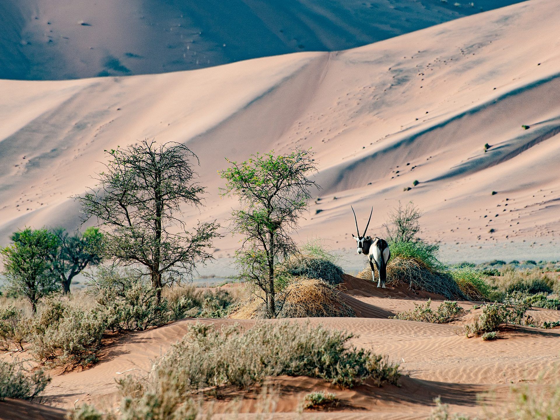
Tar and gravel conditions on the B1, B2 and the C-roads to Sossusvlei, Etosha, Damaraland and the Kalahari, rainy-season changes and realistic driving times.
Read more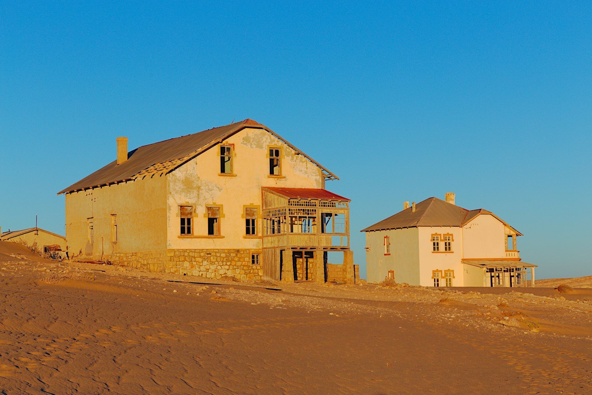
Distances, driving times and fuel stops for the classic Namibia loop, so you know where the next petrol station is and how far each leg really runs.
Read morePlanning a Namibia road trip? Get our free route-planning guide by email.
Book the 4x4, tell us the route, and we will have the paperwork ready.